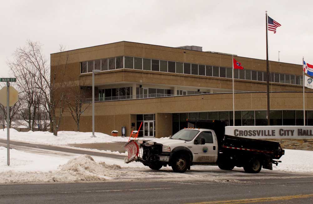
Closed school systems include Cumberland Co, Morgan County, White County, Overton County and Scott County.

Now available for Andriod in the
Play Store and Apple App Store!
Search: NewCarDawg



WINTER WEATHER ADVISORY IN EFFECT FROM
9 PM THIS EVENING TO 6 PM CST TUESDAY.
* WHAT...Snow expected. Plan on slippery
road conditions, including during the
morning commute on Tuesday.
Total snow accumulations around 1 inch
are expected. Parts of the Cumberland
Plateau could have around 2 inches,
while the far southern counties of
the Mid State will have less than
1 inch in some areas.
* WHERE...Portions of Southern Middle
Tennessee and the Plateau including
Cookeville, Livingston, Lewisburg,
Woodbury, Smithville, Sparta, Crossville,
Shelbyville, Manchester, McMinnville,
Spencer, and Pulaski
* WHEN...9 PM today to 6 PM Tuesday.
* ADDITIONAL DETAILS...Look for reduced
visibilities at times.

PRECAUTIONARY/PREPAREDNESS ACTIONS.

A Winter Weather Advisory for snow means periods of snow
will cause primarily travel difficulties.
Be prepared for snow covered roads and limited visibilities,
and use caution while driving. The latest road conditions
for the state you are calling from can be obtained by calling 5 1 1.

WINTER WEATHER ADVISORY IN EFFECT FROM 8 AM CST FRIDAY TO 6 AM
CST SATURDAY...

* WHAT...Mixed precipitation expected. The ice will result in
  difficult travel conditions. Total snow accumulations of one to
  two inches and ice accumulations of one tenth to two tenths of
  an inch are expected.

* WHERE...Middle Tennessee areas east of a Springfield to
  Centerville to Collinwood line. This includes Hendersonville,
  Gallatin, Celina, Nashville, Lebanon, Carthage, Cookeville,
  Jamestown, Columbia, Lewisburg, Murfreesboro, Smithville,
  Sparta, Crossville, Shelbyville, Manchester, McMinnville,
  Spencer, Lawrenceburg, and Pulaski.

* WHEN...8 AM CST Friday to 6 AM CST Saturday.

* ADDITIONAL DETAILS...Look for reduced visibilities at times.

PRECAUTIONARY/PREPAREDNESS ACTIONS...

A Winter Weather Advisory means that periods of snow, sleet or
freezing rain will cause travel difficulties. Be prepared for
slippery roads and limited visibilities, and use caution while
driving. The latest road conditions for the state you are calling
from can be obtained by calling 5 1 1.
A developing storm system over Texas will be spreading moisture
eastward, with precipitation expected to reach the mid state
tonight. As temperatures slowly fall tonight, eastern portions of
Middle Tennessee are expected to drop to near or below freezing by
sunrise. Freezing rain is expected to fall across our eastern
counties. With cold surface conditions, freezing rain will lead to
ice accumulations on all exposed surfaces. Improving conditions
are expected by late Monday morning as freezing rain changes over
to all rain.

WINTER WEATHER ADVISORY IN EFFECT FROM MIDNIGHT CST TONIGHT
TO 9 AM CST MONDAY...

* WHAT...Freezing rain expected. Ice accumulations will result in
  difficult travel conditions, including the morning commute on
  Monday. Total ice accumulations of up to one tenth of an inch
  expected.

* WHERE...Portions of Middle Tennessee generally to the east of a
  Westmoreland to Tullahoma line.

* WHEN...Midnight CST to 9 AM CST Monday.

PRECAUTIONARY/PREPAREDNESS ACTIONS...

A Winter Weather Advisory means that periods of freezing rain
will cause travel difficulties. Be prepared for slippery roads.
Slow down and use caution while driving. The latest road
conditions for the state you are calling from can be obtained by
calling 5 1 1.
FIRST MEASURABLE SNOW OF THE WINTER POSSIBLE TUESDAY MORNINg

The first chance of measurable snow is likely to occur Tuesday
morning in Middle Tennessee behind a cold front that will pass
through the area Monday tonight. Winds will shift around to the
northwest and as they do, the northern half of the Cumberland
Plateau will begin to see the snow fly. Starting around 5 am, most
everyone will see less than one inch of snow, however, higher
elevations could see as much as an inch and a half by 10 am.
WINTER WEATHER ADVISORY IN EFFECT FROM 5 AM TO 10 AM CST TUESDAY. * WHAT...Snow expected. Plan on slippery road conditions, including during the morning commute on Tuesday. Total snow accumulations of up to one inch are expected, though some spots could see a little more. * WHERE...Pickett, Putnam, Overton, Fentress and Cumberland County. * WHEN...5 AM to 10 AM Tuesday.A Winter Weather Advisory for snow means periods of snow will cause primarily travel difficulties. Be prepared for snow covered roads and limited visibilities, and use caution while driving. The latest road conditions for the state you are calling from can be obtained by calling 5 1 1.

WINTER WEATHER ADVISORY IN EFFECT FROM 6 PM CST THIS EVENING
TO 7 AM CDT SUNDAY

The National Weather Service in Nashville has issued a Winter Weather Advisory for up to an inch of snow, which is in effect
from 6 PM CST this evening to 7 AM CDT Sunday.

* TIMING...Saturday night, mainly after midnight.

* MAIN IMPACT...Driving conditions may become hazardous.

* OTHER IMPACTS...Limited visibilities and damage to vegetation that has already bloomed.

PRECAUTIONARY/PREPAREDNESS ACTIONS: A Winter Weather Advisory for snow means that periods of snow
will cause primarily travel difficulties. Be prepared for snow
covered roads and limited visibilities...and use caution while
driving.
LIGHT SNOW ACCUMULATIONS EXPECTED ON THE CUMBERLAND PLATEAU
THIS EVENING.

.LIGHT SNOW IS EXPECTED ACROSS THE NORTHERN CUMBERLAND PLATEAU,
MAINLY THIS EVENING. MOST AREAS WILL HAVE ONE HALF TO 1 INCH OF
SNOW...WITH 1.5 INCHES OF SNOW POSSIBLE FOR THE HIGHEST
ELEVATIONS.

WINTER WEATHER ADVISORY NOW IN EFFECT FROM 3 PM THIS AFTERNOON
TO MIDNIGHT CST TONIGHT

* TIMING...LATE THIS AFTERNOON THROUGH MIDNIGHT.

* MAIN IMPACT...LIGHT SNOW ACCUMULATIONS COULD CAUSE SLICK ROADS
  IN SOME AREAS, ESPECIALLY ON BRIDGES AND SECONDARY ROADWAYS.

* AMOUNTS...TOTAL SNOW ACCUMULATIONS OF ONE HALF TO ONE AND ONE
  HALF INCHES ARE EXPECTED ON THE PLATEAU IN THE ADVISORY AREA,
  INCLUDING JAMESTOWN, MONTEREY, AND CROSSVILLE, COOKEVILLE, AND
  SPARTA.